How to Use the Mapping Tool
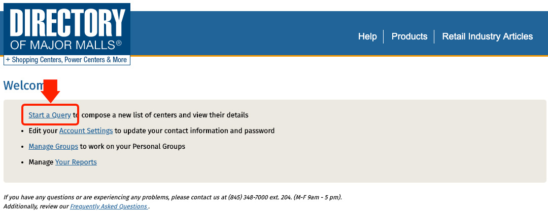
1. Run a search query by clicking Start a Query:
2. From here you can filter based on many different categories:
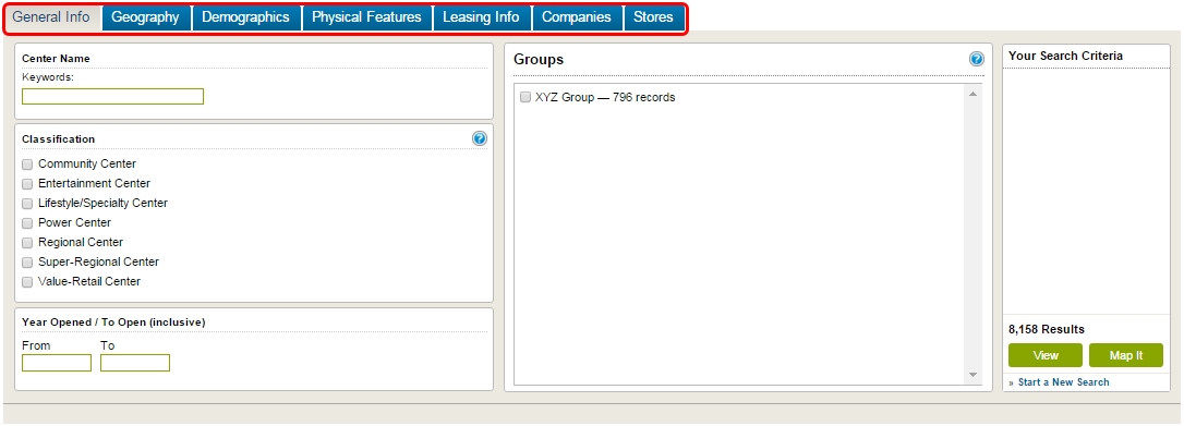
Note: You may search a single category to filter results or apply multiple categories altogether.
There are 7 search categories which include: General Info, Geography, Demographics, Physical Features, Leasing Info, Companies, and Stores
(Part I)
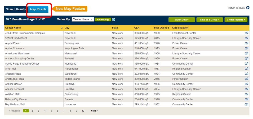
3. Run a basic query from a single category or combination of queries mentioned above. Then press the View button and scroll-down for the list.

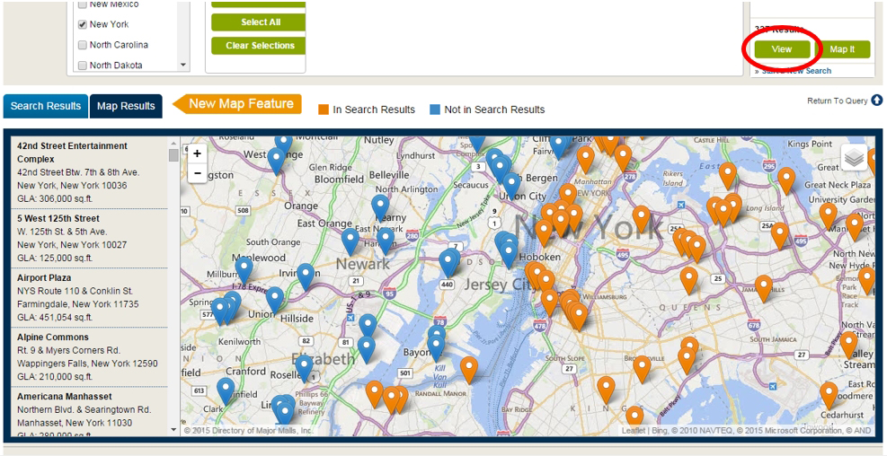
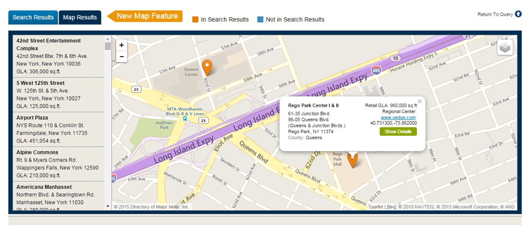
4. Results can be viewed as a map by clicking the Map Results button (or Map It from the search screen):
5. From here you will see a list on the left side (Section A) of shopping centers in alpha-numerical order by company name. On the right hand side (Section B) the map of the area you were searching.
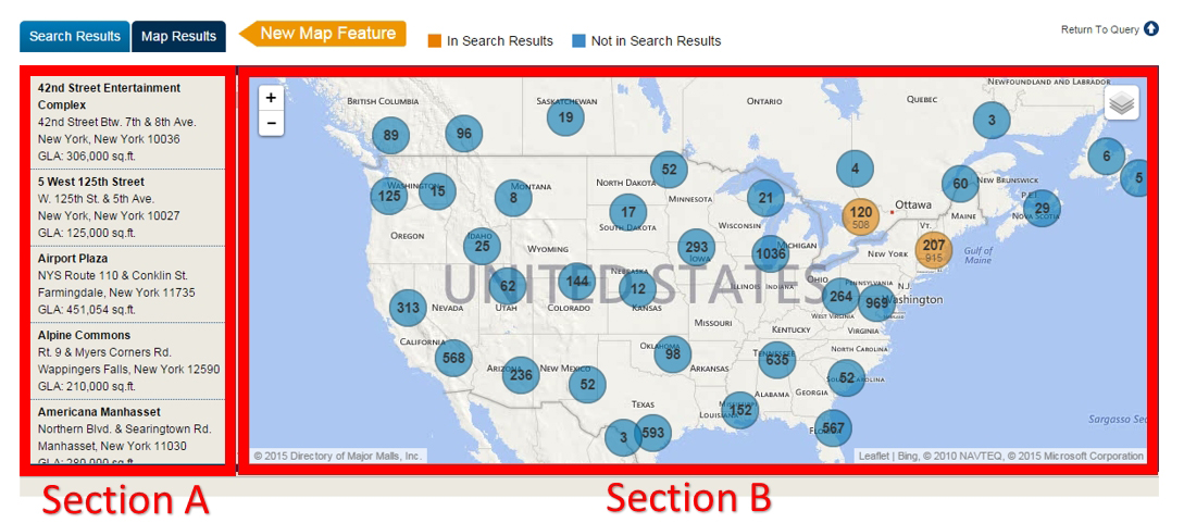
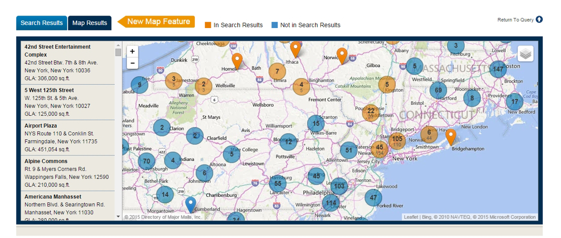
Note: The Orange circles are the shopping centers in your results and the Blue circles are the ones Not in your search results.

The number in the circle is the quantity of centers in that area. As you zoom in, the circles expand and reveal the individual center locations.
6. Move around the map by placing the cursor on the map and by left clicking and dragging it around.
7. There is also an option to zoom-in and zoom-out on the top left corner of the map. That can also be accomplished by rolling the mouse wheel up to zoom-in and by rolling the mouse wheel down to zoom-out.
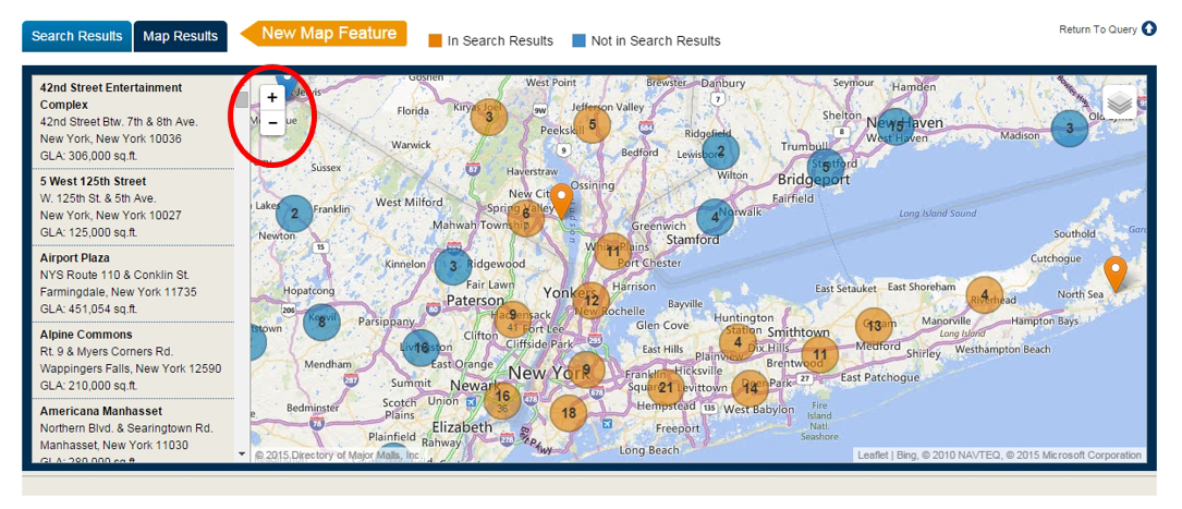
8. Click on each map point to identify the center. Use the Show Details button to view complete details for selected center
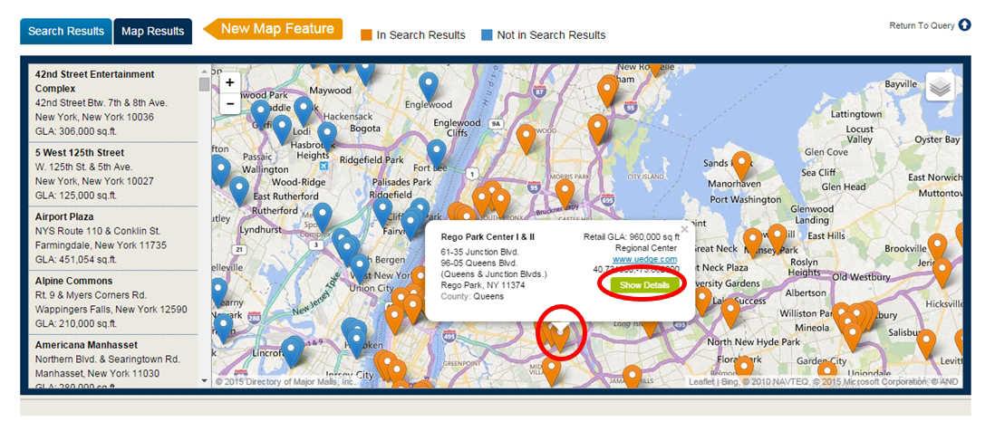
9. Zoom-in even closer:
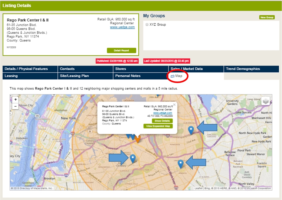
10. After clicking Show Details, scroll-down to view listing details. From there, click the Map tab to view centers within a 5-mile radius.
Tip: If you are having trouble scrolling down the page and instead, you are zooming-in the map. Click anywhere outside the whole map, then use the mouse wheel to scroll-down.
(Part II)
Changing Map Views
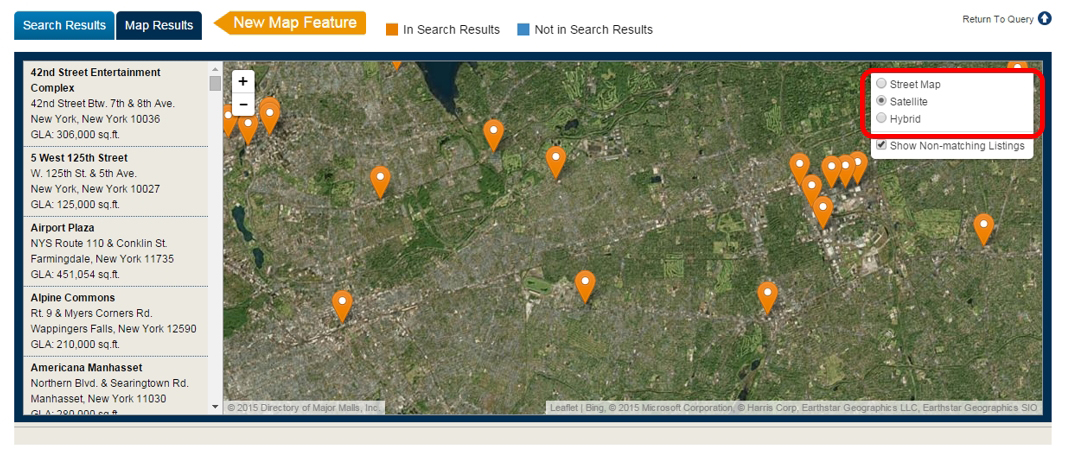
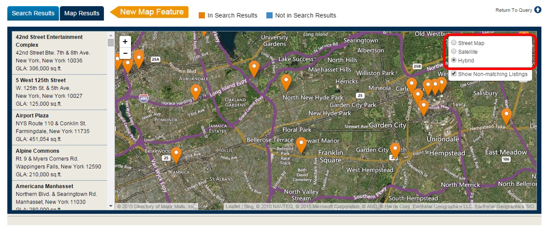
1. Click on the top right corner of the map.
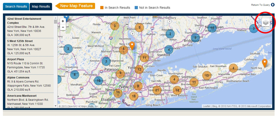
2. You can view with 3 different options. Street Map view (Default), Satellite, and Hybrid.
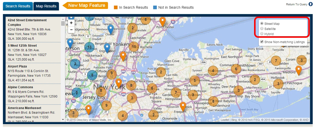
A. The Street Map view (Default), which is shown like with the names of cities, streets, roads, and highways.

B. The Satellite view is shown with satellite pictures of the terrain and building when zooming in. However, you will not see any names of cities, streets, roads, and highways.
C. The Hybrid view is a combination of the Satellite and Street Map view, which shows the terrain and buildings along with the names of cities, streets, roads, and highways.
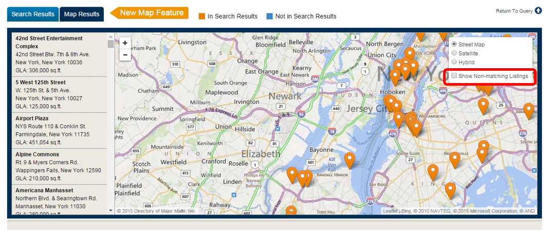
Note: You can decide to hide Non-matching Listings by unchecking Show Non-matching Listings.
Before: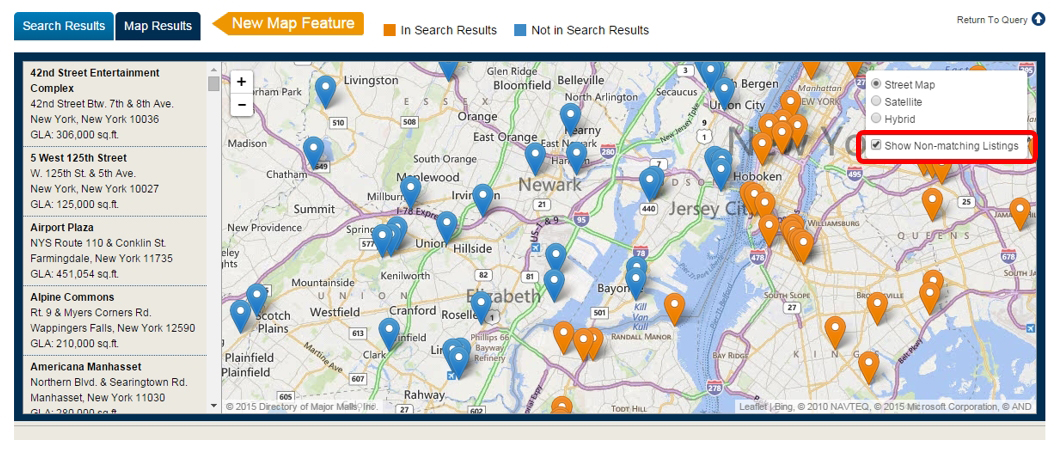
After: The blue locations (non-matching) are hidden.
3. And lastly, if you would like to return to viewing your results as a List, simply scroll-up and click the View button: